The original Suwon to Inchon line (수인선 협궤열차) ran all the way from Inchon harbour to Suwon (수원) station, but by the end of the existence of the line this was no longer the case. But like other parts of the line which were still there long after the railway had been closed the part from Ansan (안산) station to Inchon was completely demolished (save for a few bridge and some shorter stretches of line) only relatively recently when the new subway line from Oido (오이도) to Songdo (송도) was constructed on top of the old line. Even more recently other parts were demolished in order to contruct an interchange with the new Daegok-Sosa-Wonsi Line, meaning that a new station (Choji, 초지역) will come into existence soon, replacing Gongdan (공단) Station. Even then however there are still remnants left out there, between Gojan (고잔) station and Ansan station.
Gongdan (공단) Station in the early 1980s. (Source: http://blog.daum.net/kimcmblog/345; Ansan Tours)
The rest of the article including maps and satellite pictures after the break.
Map showing the area described in this article (click for a larger version). At (1) is Gojan (고잔), station number 451 on the subway map. This particular stretch of the old railway starts at (2), which is the end of the stretch described in a previous article. At (3) is an area were quite a lot must have happened, nothing can be found here and a new short canal has been dug. The station at (4) is Gongdan (공단) Station, number 452 on the subway map. However, this station will be renamed to Choji (초지) when the new north to south Daegok-Sosa-Wonsi Line opens. To physically connect these lines two short lines are currently (2013) under construction. This is unfortunate, as it means that some of the last remnants of the narrow gauge line have finally been lifted. The same is true at (5), where the narrow gauge line ran under the commuter line during the late 1980s and until closure of the narrow gauge line in 1995. At (6) is Ansan (안산), where the commuter line ended while the narrow gauge line went on to Songdo (송도). Today nothing is left of the old line in this area. The area around (7) was not visited at this time, but it seems nothing is left there either, as a short trip on the same day to Oido (오이도) seemed to confirm.
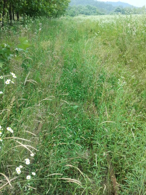
This picture tour starts at the Choji Road (초지로). At this point the track is still there, but the grass has pretty much overgrown everything and only from a close distance can the tracks still be seen.
The track here is close to the commuter line, but obviously far away enough to have survived until now. Anywhere the narrow gauge tracks were in the way they have been removed, but this distance has spared this part of the line.
At some points the rails can be found easily, and just a few years ago they might have even still been visible on some of the satellite maps. The grass seems to have grown rapidly recently, pictures from 2007 and 2009 show that the line was not yet overgrown during those years.Looking back towars Gojan station (to the east). The grass is tall, these pictures were taken in July 2013. The spot is between (2) and (3) on the map.At (3) a canal exists. This canal must have been built after 1995, as it is not on older maps and there are no remnants of any narrow gauge railway bridge here. From this point onwards nothing could be found for quite some time.
Satellite picture (Naver) showing the canal at number 3. At 2 the track ends, while 1 is towards Gojan Station. Around 4 is the mess shown in the next picture.
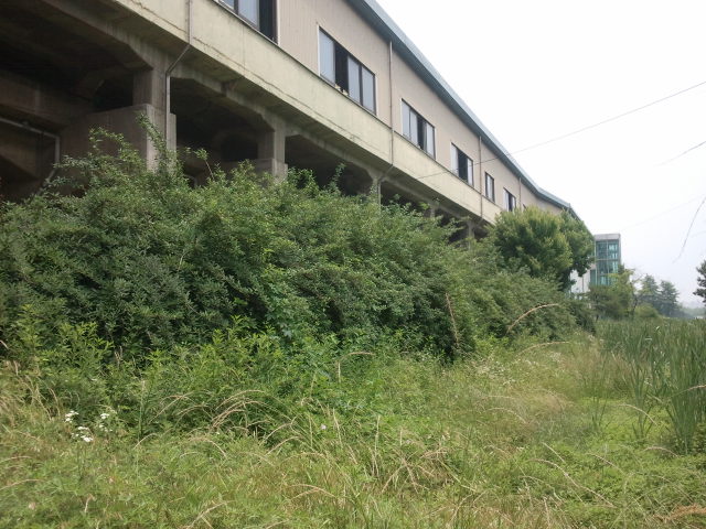
The whole area between the canal at (3) and the next station was one huge mess, clearly something had been going on here. But whatever it was, it had destroyed the old line.Another view of the mess at this point. It might be that this is debris from some construction site in the neighbourhood. Since this area has been developed very rapidly in the last decade a lot has been going on, and this might be one of the results of all that.Nearing the next station, Gongdan (공단) Station, at (4) on the Google map in this article. Everything is changing here because of the new connecting line, which will run from left to right in this picture, the new station, Choji (초지), will be to the right of Gongdan Station. In the distance is the present day Gongdan Station. All tracks are gone, they used to run straight through what is now a construction site.The back of Gongdan (공단) Station, at (4) on the Google map. The tracks should be here, but they were nowhere to be found on this side of the station. View towards the west.The same side of Gongdan (공단) Station, but now looking east. Still no tracks unfortunately, even though no building had been going on here recently.But just past Gongdan (공단) Station the tracks can still be found. At first it is not very noticeable, but the tracks are there. This part of the line was used until the last day of the line and since then nothing much has been done at this particular point, so the tracks are simply still there.
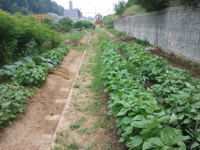
Between the vegetables the rails can be seen. To the right is the trackbed of the commuter line, up ahead is part of the construction site of the new interchange between the two commuter lines.Looking back towards the station building it is difficult to see the tracks. They are there however, and since nothing is being done here they will stay there for quite some time.The tracks near the construction site to the west of Gongdan (공단) Station. This is the southern track of the commuter line interchange under construction. On satellite pictures (available on either Daum, Google or Naver) nothing of these construction activities can be found yet. This is quite confusing, because what used to be here was a bridge over the narrow gauge line. The track would go from the southern side of the embankment of the commuter line to the northern side.A cutout from Naver. This picture clearly shows the route of the underpass at this point. The satellite picture is outdated, today this area already looks quite different. But even in 2012 the old narrow gauge line was still there.
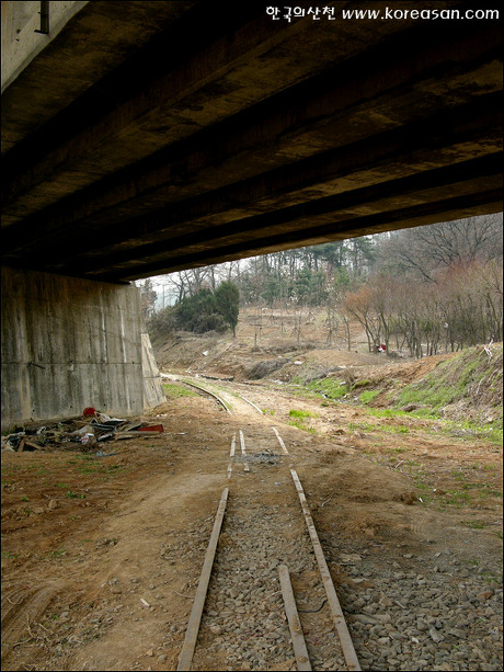
A series of pictures showing the old situation at this point. A railcar coming from Inchon going to Suwon just before going underneath the main commuter line track.The same spot in 2006. (Copyrights in the photo.)Two pictures taken by another photographer in 2007, showing more detail.Apparently guard rails had been installed on this part of the line. On the original site more pictures can be seen of this particular part of the line. (Copyrights). http://blog.daum.net/koreasan/11213267)
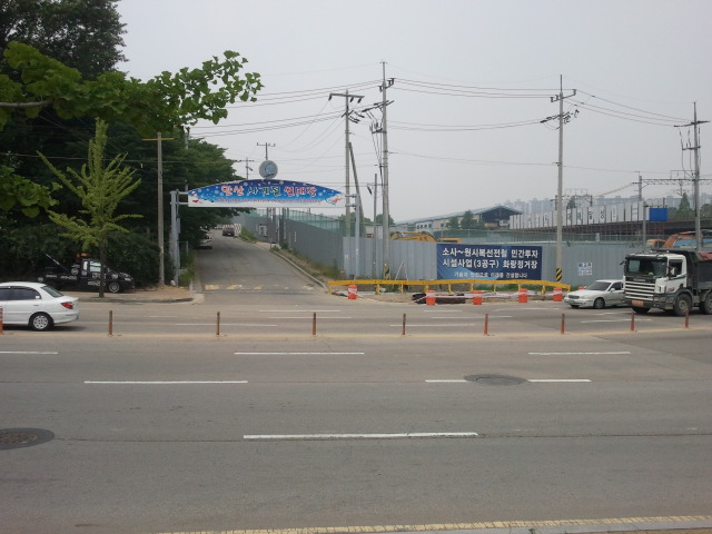
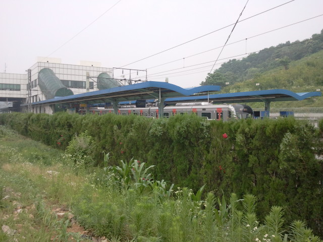
This is how it all looks like in 2013. The new interchange is under construction and the old narrow gauge track has been demolished completey.The reason for all the demolition can be found on the newest version of the subway map available on all subway stations. Gongdan Station has been renamed to Choji and the two thin lines are the interchange between the two mainlines.Present day Ansan station. There are no traces left of the old narrow gauge line here.
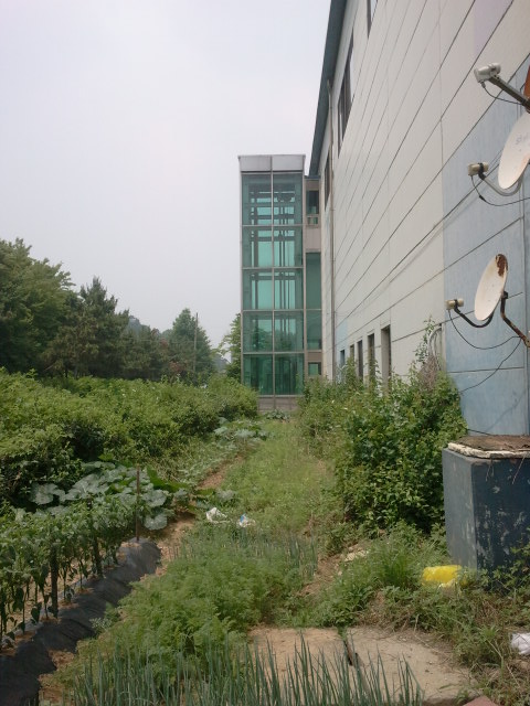
View across the tracks near Ansan station. The bridge is a great photo point, but not much different railway stock can be seen: only the commuter trains run here. Even though in the 1970s this standard gauge line was already proposed as a freight line to relieve the old Seoul – Inchon line, this never materialized, and so freight trains do not pass through this point.View from the overpass towards Ansan station.View from the overpass towards Choji station. It seems the narrow gauge line might have run in the last few years next to the railway line on the high ground, as the Naver map shows a path from the underpass in previous pictures to this point.Railcar shed at Ansan station. These lines were never used for the old narrow gauge line, the narrow gauge was serviced at Suwon station.As mentioned in the introduction not much is left from this point onwards towards Inchon, it seems that just like at the KTX viaduct between Ansan (Sari) and Suwon here too the entire trackbed has been reused for the commuter line. This is the situation at Oido Station.Another view of Oido station, this time towards the station buildings. The area is now a huge garden, used by the local people to grow vegetables.However, one other small bridge can still be found between Ansan and Inchon. Between Wolgot Station (월곶) and Darwol Station (달월) this small bridge is located right next to the commuter line (which is the concrete bridge in the background).To end this article, another view of the old narrow gauge line running through this area.
 The original Suwon to Inchon line (수인선 협궤열차) ran all the way from Inchon harbour to Suwon (수원) station, but by the end of the existence of the line this was no longer the case. But like other parts of the line which were still there long after the railway had been closed the part from Ansan (안산) station to Inchon was completely demolished (save for a few bridge and some shorter stretches of line) only relatively recently when the new subway line from Oido (오이도) to Songdo (송도) was constructed on top of the old line. Even more recently other parts were demolished in order to contruct an interchange with the new Daegok-Sosa-Wonsi Line, meaning that a new station (Choji, 초지역) will come into existence soon, replacing Gongdan (공단) Station. Even then however there are still remnants left out there, between Gojan (고잔) station and Ansan station.