Near the present day Soraepogu Station (소래포구) on the current Suin (commuter) line from Oido to Songdo a long bridge of the former narrow gauge Suin line can still be found. This bridge is simply named “Sorae Railway Bridge” (소래철교) and as such can be found on the online Naver, Daum and Google maps.
The easiest way to reach this spot is to walk from Soraepogu Station (소래포구) towards the water front. Next to the waterfront the Sorae History Museum can be found, which contains a lot of information about the railway, including an actual carriage from the line! In front of the museum is engine 7 (see a previous article).
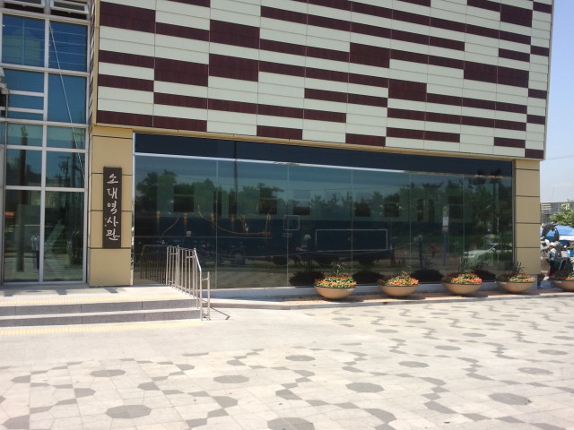
The Sorae History Museum, 2013. The main window actually shows two distinct objects related to the Suwon to Inchon narrow gauge line: outside the building is engine 7, the steam engine which can be seen reflected in the window (look for the yellow and white lines). However, inside the building a white and blue railway coach from the same railway can be found!Railcar and trailer on the Sorae Railway Bridge in 1988, just 7 years before closure. In 1988 not a single high rising building had been constructed yet, the area is stunningly empty!
More pictures plus maps of the location after the break:
The first thing which can be seen from engine 7 and the Sorae History Museum is the old embankment of the line next to the road. The railway had to get up onto the bridge, so the railway embankment is much higher than the surrounding area. Only the part running up to the bridge is still here. The step lead up to the railway line.
Looking back towards Sorae (to the west) a very small part of the line is still visible, but that’s it, nothing else is left here.
On the embankment the track can no longer be seen, but underneath the boarding the rails are very probably still there!
The actual railway bridge at Sorae starts here. The picture above the gate actually states this is the Sorae Railway Bridge.
From the bridge the new concrete bridge for the commuter line can easily be seen. This is a train coming from Wolgot Station (월곶역) going to Sorae.
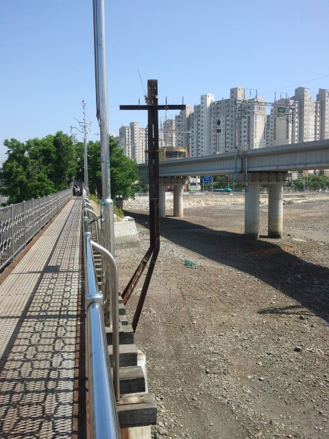
The rails are still there, complete with guard rails
Attached to the bridge were several supports for the signalling system (by telephone). They are still there, but the wires are of course gone.The second support on the bridge. At low tide both the bridges create a shadow on the bed of the waterway which shows up very well in satellite pictures.
View of the bridge, looking towards Sorea (west). The bridge gives a good view of the tidal differences. The green roofs to the right are the local fish market, complete with fishing boats in the mud.
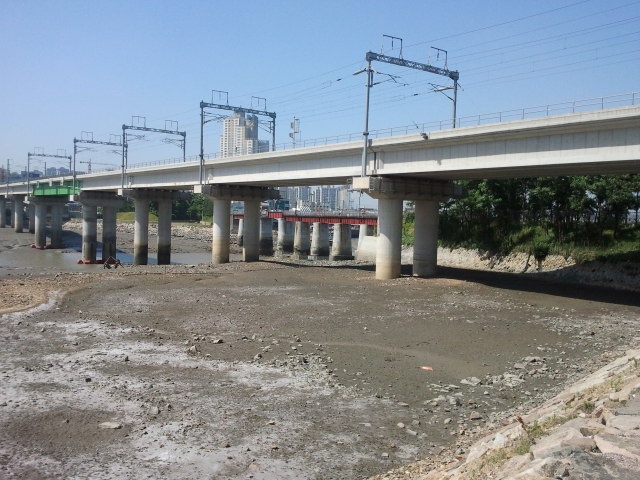
An overview of the old (narrow gauge) railway bridge at Sorae (view west). At low tide the pillars show up quite well. None of the high rise buildings were here 25 years ago, when the line was still open.
View from the old bridge towards the new Wolgot station on the commuter line. Nothing of the original embankment is left here, it was all demolished to make way for the new line.View of the old narrow gauge bridge seen from underneath the new bridge at Sorae.
All this can be found easily on the maps available online. This is for instance the Daum map of the area:
Naver map of the Sorae Railway Bridge area. Note the scale indicator.The same map from Naver, but as satellite picture. The shade of the bridge shows up very well.
But Google maps also has a good map of the area. Interestingly the old bridge is not on the map, but if you turn to satellite view the bridge can be seen easily. The same is true for the Daum map: no bridge shows up in the map view, but when the satellite pictures are shown, the bridge is there. Notice how the new SuIn line is still being built on the Daum and Naver satellite pictures, but the bridge is definitely under construction in this view; today, in 2013, the subway is up and running here.
All pictures were taking in June 2013.
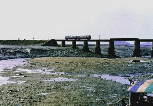
Another historical shot of the bridge at Sorae, probably from the 80’s.